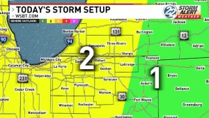

Strong to severe storm set-up in the works for late Sunday, Monday evening
After a break from hot, active weather, summertime heat makes a big return along with strong storm chances.
Most of Sunday will be dry and hot with highs in the upper 80s. Humidity will be high, making us feel more like the 90s.
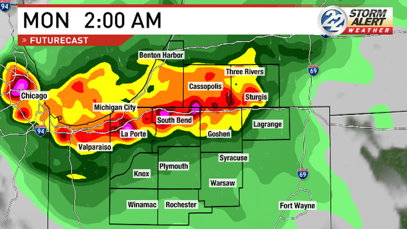
Our first round of storms arrives overnight Sunday into early Monday morning.
The Storm Prediction Center has placed part of our area under a Level 2 risk for severe weather for tonight.
Storms will be likely after 11 p.m. and could contain damaging wind gusts.
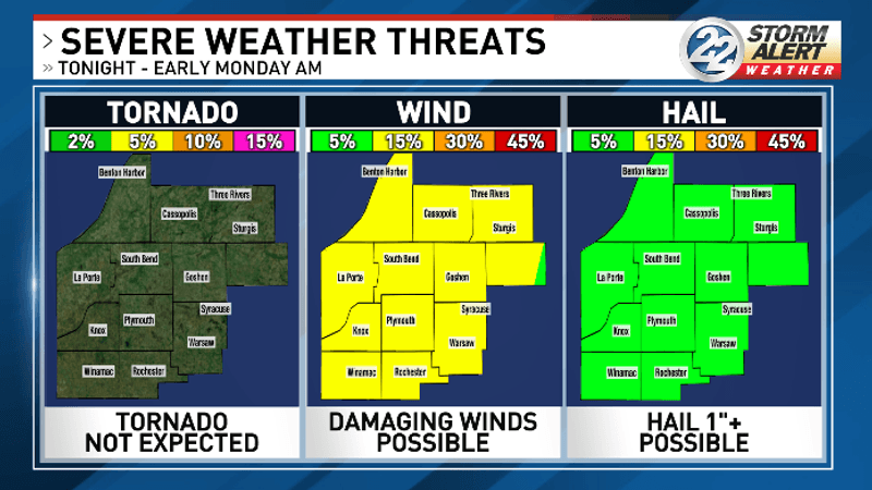
Some showers could linger into Monday morning before drying out.
Monday will be another very hot and muggy day with highs nearing 90.
Another round of storms arrives Monday evening, likely after 6 p.m.
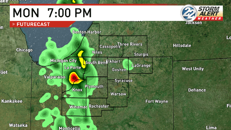
These storms will be able to work off the day’s heat and humidity, which will give them the potential to be stronger than the first round.
The Storm Prediction Center has placed our whole area under a Level 2 risk for severe weather Monday evening.
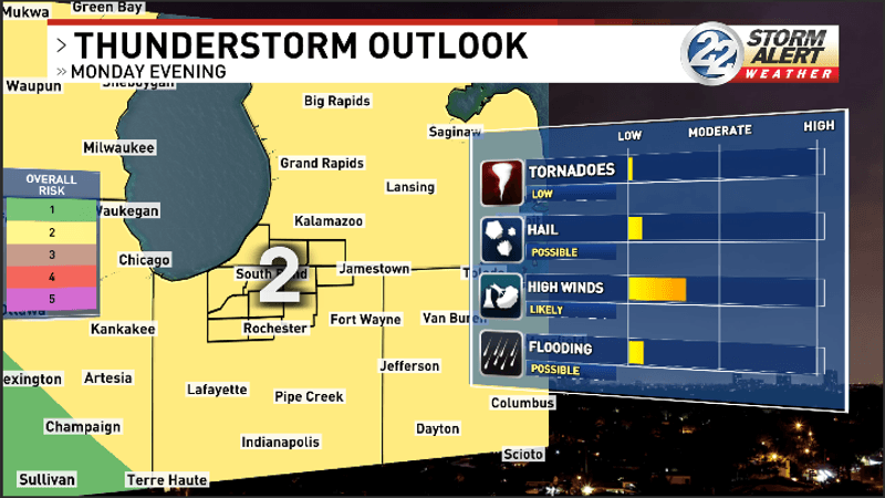
Damaging winds are the main concern for this round of storms, however hail and even an isolated tornado cannot be ruled out.
It is always a good idea to have multiple ways to receive weather alerts. A good tool to have on hand is the Storm Alert Weather App. The app will notify you of any watches or warnings, and you can track storms in real time on radar. The app is free to download on the AppStore and Google Play.
After this round of storms, things will quiet down.
Rain chances look very low the rest of the week. We likely will not see any more rain until possibly Friday.
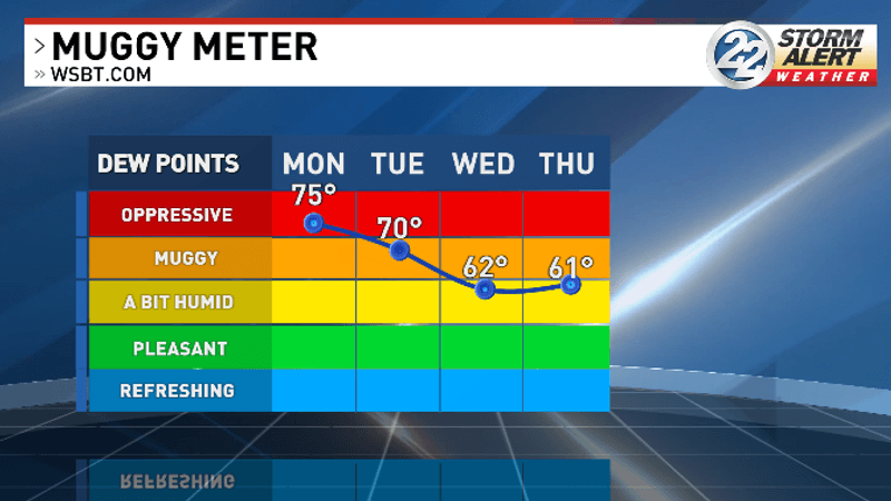
Our humidity will back down a bit in the wake of the storms. There will still likely be a bit of humidity, but it will not be as oppressive.
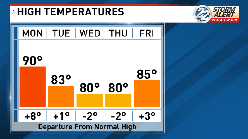
Temperatures will also fall to a more seasonable level for the rest of the week. Highs will be in the low to mid-80s through Friday